The Australian Koala Foundation (AKF) is proud that we have been able to ensure that the federal government took responsibility for Koalas and sadly this has taken many many years.
Following the 2006 decision by the federal government to not list the Koala as ‘Vulnerable’, the AKF made the decision that in order to protect the species, we needed to have confidence in just how many Koalas remained in the wild, and where those Koalas were located. This resulted in Bob’s Map (named after the past chairman of the AKF); a project, based on best science, with the specific aim of estimating and monitoring the national Koala population.
Since that time, there has been a Senate Inquiry in 2011 which recommended the Koala be listed as Vulnerable under the EPBC Act but it was only in New South Wales, Queensland and the ACT and was so in May 2012. Victorian and South Australian missed out. Then, 10 years later, the federal minister upgraded the Koala to Endangered, a shocking indictment on our government. South Australian and Victorian Koalas are still not protected and why the AKF wants a Koala Protection Act.
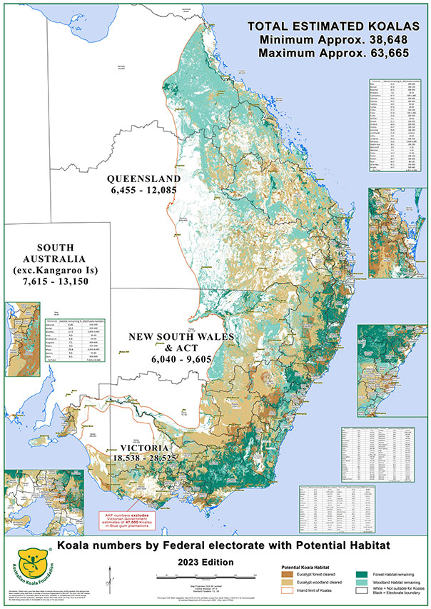
Bob’s Map 2023 Edition: Click image for larger view
Bob’s Map is the result of more than $15 million and 30 years of research. These maps simply and powerfully illustrate the dramatic impact humans have had on the Koala’s landscape, not to mention the devastating losses the land has felt since Europeans first settled in Australia. It’s not just the trees lost over the last 235 years, but the impacts of this habitat loss on millions of species, on the soil and water, on the climate, and on our general quality of life. Today, the pressure on the Koala is even greater and forests continue to be destroyed at an alarming rate.
The Science
Vegetation Mapping
Initially National Vegetation Information System (NVIS) Version 1.0 data was used to map potential Koala habitat on the East coast of Australia. Of the 26 NVIS classes we selected four classes containing tree species that might be suitable for use by Koalas. Vegetation mapping was initially split into regional ecosystems, and later reapportioned by federal electorate. As the Federal Government and its elected parliamentarians are the ultimate guardians of the species, it was felt appropriate to examine the issue on this basis. For a map of your local Federal electorate and how your local member scores, visit Act or Axe.
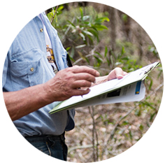
Field Data Collection
While conducting research to develop the AKF Koala Habitat Atlas (KHA), the AKF has accumulated a database of records for over 100,000 individually assessed trees from 2,000 field sites in 16 of the 30 bioregions the Koala is known to occur. At each field site, Koala habitat utilisation and tree species preferences were assessed. Combined with vegetation maps this data allows AKF researchers to estimate the amount of habitat remaining, and to rank that habitat in terms of its suitability for Koalas.

Estimating Koala Abundance
AKF has developed over 250 KHAs providing data on the amount and quality of available habitat. Additionally, we have made use of the results of a number of published studies conducted by other researchers. With this data we can model estimates of the proportion of habitat occupied by Koalas, potential Koala densities and home range sizes in each class of habitat and use this information to predict the number of Koalas in each area. The results are validated and adjusted if necessary using information provided by researchers and local community groups working in the local area.
Koala Population Estimates 2018 vs 2021
ARCHIVAL DATA
Bob’s Map update circa 2021
Since 2018, there has been an estimated 30% decline in Koalas across Australia, with populations estimated to be between 32,065 – 57,920 down from 45,745 – 82,170 in 2018. The numbers show a disturbing trend:
- A 30% decline in total Koala population since 2018. NSW is worst with a 41% decline
- Koalas are now extinct in 47 electorates with only one electorate having more than 5000 Koalas.
- Every region in Australia saw a decline in population – no upward trends.
- Some regions have remaining populations estimated to be as small as just 5-10 Koalas.


